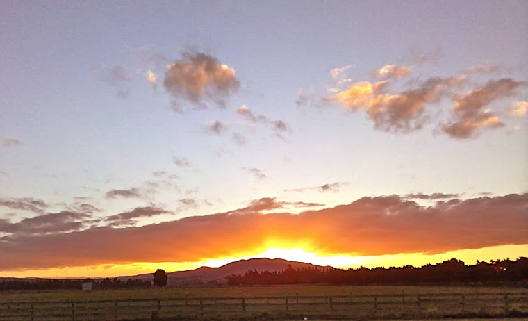
For those who don’t know much
about my little corner of the world, Bank's Peninsula sticks out of the eastern coast of Te Wai Pounamu – more
commonly and prosaically known as the South Island of New Zealand. To Māori, the
Peninsula was Te Pataka o Rakaihautu.
Captain Cook, named what he thought was an island after naturalist
Joseph Banks and it was once an island until the great rivers that flow out of the Southern Alps deposited enough gravels and soils to join it to the
mainland.
It is the twin craters of ancient volcanoes whose seaward sides have
been eroded through to the crater hearts, creating two deep-water harbours –
Lyttelton and Akaroa – along with many other bays and inlets. The Māori name for Lyttelton harbour is Te Whakaraupō - harbour of the
Raupō – the reeds that once filled the
marshy area at the head of the harbour.
Before European settlement the 1150 square km peninsula was still
largely forested with tōtara, tī kōuka, kahikatea, mātai, akaake, miro, puruhi,
houhere, kānuka, mānuka, harakeke, tarata, kōhūhu, korokio, koromiko, nīkau, mānatu,
makomako, whauwhaupaku, horoeka, horopito, matipou, kawakawa, rōhutu, karamū,
tītoki…..and many other trees, shrubs, flaxes and grasses which formed the diverse
coastal and hill forests that blanketed the land.
Most of this glorious and diverse forest was lost in
the first 50 years of European settlement – either logged or burned. The Canterbury Plains and the Peninsula are among the most altered landscapes in one of the most rapidly altered countries in the world.
Along with the forest went the millions of birds that depended on it;
and with the birds went the nutrient rich droppings which fed the bush and the soils that overlaid the igneous rocks. The land the logging and fires exposed was mostly very steep and
deeply folded, having been formed by lava flows. Many of the streams that trickled out of gullies dried up
once the bush had gone.
Many of the
old hill farms on the peninsula were marginal because the land is so steep and folded, and because of the loss of the deep damp litter of the
original forest floor with nutrients provided by the droppings of millions of
birds, the soils quickly lost heart. The loess erodes in the wind and
rain and it dries out fast and hard. In light rain the exposed soil turns as slick as ice, and in heavy rain into a sticky porridge. Holes in the volcanic rock can collapse and trap animals. They can also
harbour fire.
The fire risk was massively increased when settlers planted fast growing
gorse and pines to try to stabilise the land and to give shade and shelter to, and
contain sheep and cattle. Gorse quickly
became a very harmful noxious weed because in NZ it flowers almost all year
round, is highly flammable, broadcasts its fire resistant seeds widely, and
nothing eats it. Pines, which tend to poison the ground beneath them,
are invasive and flammable and co-exist very happily with gorse which colonises
pine forest margins and spreads to open land.
The part of the peninsula to the south of Christchurch / Ōtautahi is known as the Port
Hills which form a 300m barrier between the city and the port. There are three roads into and out of
the port other than the road tunnel: Evans Pass, which went up from Sumner and
came down into Lyttelton from the east and was so badly damaged in the February
2011 earthquake sequence that it remains closed on the Lyttelton side; Dyers Pass, which runs over to Governor's Bay and is closed at
the time of writing this because of the fires; and Gebbie’s Pass, which runs in
through the low hills at the head of the harbour.
The scenic Summit Road, which runs along the crater rim, was meant to have
a series of tea shops named after native birds of which only three were ever built
and two remain. The Summit Road was the creation
of the visionary, Harry Ell.
The three road passes and the Summit Road give people
access to a wide variety of walks and bike paths on the hills and to the numerous small communities that have grown up in the bays around the harbour.
It is fair to say that the Port Hills and the peninsula more widely, occupy a special place in Christchurch-Otautahi history and in the hearts of most of the people
who live there.
Generally the city turns its back on the sea because of the
prevailing strong and cool on-shore easterly winds, and the city’s eastern
suburbs are largely working class. The hills have always drawn the more affluent and their interest pushes up the price of land. People have built homes on the hills and cliffs above the
small Christchurch seaside suburbs of Sumner and Redcliffe and along the roads
that lead out there from the city for generations because of a microclimate and the spectacular
views across Pegasus Bay and / or the Southern Alps.
The new housing developments west of the older hill suburbs are the latest
encroachments on the hills, with higher density housing on the lower slopes,
and lower density housing further up where the views are the best.
In addition to the encroachments of housing, some of the old hill farms
have been subdivided into what are known in NZ as lifestyle blocks. Mostly the people who buy these blocks
have to work to earn the money to live on them, which is why they’re often
referred to as "life sentence blocks".
These blocks range in size from .5 of a hectare to 25 hectares,
after which they become small farms. Lifestyle blocks tend to have smaller paddocks than hill farms and the owners
plant more trees – which is a good thing except they tend to plant fast growing
exotic species like pines, conifers and gums.
The grass cover throughout Canterbury this time of year, other than the land under irrigation for dairying, is tinder dry. If grass is left long under fences, i.e. not grazed hard by sheep or sprayed, fire will
track along fence lines igniting fence posts. These posts are treated with
highly toxic chemicals that are released into the atmosphere when burned and
fire can also smoulder in them underground.
There’s an increased fire risk from overhead power
lines shorting onto trees or if a transformer is overloaded and blows, or
when electric fences short onto dry vegetation – as well as sparks from exhausts, mowers etc.
Although Christchurch got normal rainfall over the
last year it wasn’t enough to replenish soil moisture levels depleted by preceding years of drought. We’re in the driest part of the year so trees are
stressed, leaf dries out and falls early, the litter on the ground becomes
tinder dry, and wherever the sun can get at it, very hot. It takes very little to ignite it.
All vegetation will burn in certain conditions – anyone who has burned gum tree slash will know that even when green and soaking
wet, once the water evaporates and heat gets to the oils in the leaf, it will
explode. The same with pines and gorse. Arguably the key element in this fire was the heavy fuel of mature pine trees. All the really big wildfires in NZ have been in pine
forests, and most of the ones in the South Island have occurred in
February.
The Port Hills now have extensive commercial pine
plantations, a lot of it owned by companies like McVicars, which owns the land
the new Canterbury Adventure Park is on. Commercial pine planters are notorious for not cleaning up litter from
trimming trees or after logging. They’re not required to provide things like storage
ponds for firefighting and their attention to fire breaks may not be all it should
be.
The Fire
I first heard of the Early Valley fire at 6.30pm
Monday and it had been burning for a couple of hours or so by then. A strong
north-west wind was blowing which was forecast to blow all night and the
following day.
The Canterbury
nor-wester is a foehn wind – dry, hot and powerful. That wind, plus tinder dry
conditions and decades of poor land management, provided the conditions in
which a fire – if it got away – had
the potential to roar right across the very steep pine, grass, gorse and bush
covered hills.
I had an ominous feeling that the fire was going to be
a bad one. That feeling became worse when I heard about a second fire on Marley
Hill to the east. Fire can’t be fought from the air at night or in low
cloud cover, and with power pylons and convection currents it’s highly dangerous
even in daylight. The nature of the fire meant it was almost impossible to get in front of it from the ground.
If I, as a lay person, could work out that this first
fire needed to be hit with everything that could be mustered while there was
still daylight, how come the people managing the fire seem not to have done the same?
I don’t mean the people on the ground – for whom I
have nothing but praise – I mean those people whose job it is to assess the
situation and deploy the necessary resources as rapidly and effectively as
possible.
The situation seems to have been exacerbated by the
intrusion of jurisdictional issues. The rural fire chief who made the statement on TV that the rural service
knows how to deal with rural fires while the urban firefighters just rock up
and plug their hoses into a hydrant – may have betrayed a schism that has no
place in an emergency service at any time, let alone when facing a fire of this
magnitude.
It also exposes New Zealand’s rigid bureaucracy, which
too often leads to an inability to respond fast and effectively. In rescuing and housing animals,
catering for exhausted firefighters, offering accommodation for evacuees and
their animals – the public was sprinting far ahead of the authorities in the
first two days.
The first responders to the fire were the professional
firefighters from Christchurch city and they and various members of the public
fought the fire initially but were struggling to contain it. They had been deployed because the fire was
at the edge of the city and there’s always a delay with the rural fire service
because volunteer firefighters have to get from home or place of work to fire
stations, get geared up and get to the fire. The
professionals from Christchurch were stood down and because the fire was
within Selwyn District Council boundaries, the Selwyn rural fire service then led
on it.
By the time the second fire was reported further east along
the Summit Road within city boundaries, it was too late to hit either fire
with helicopters or fixed wing planes so both fires burned out of control overnight
gathering massive energy and momentum. The two fires eventually joined up and the
cold air sinking into valleys at night took it back down the hills and onto
houses.
As to the anticipated wind change to north-east on Wednesday
which the person leading on the fire hoped would blow the fire back onto
already burned land – I’m not sure how a north-easterly wind would blow a north-westerly
driven fire back on itself and it seemed to take no account of the fact that
the second fire was to the east of the first. That aside, given the vagaries of
convection currents in steep folded land and fire’s propensity to take lines of
least resistance, it was obvious it was already in a state of extreme
unpredictability.
This was not the biggest wildfire in NZ's history – what made the Port Hills fire so dangerous was that it was just 6 kms from Christchurch city centre.
This was not the biggest wildfire in NZ's history – what made the Port Hills fire so dangerous was that it was just 6 kms from Christchurch city centre.
If we are in an era of climate change driven east
coast drought and increased fire risk, then these jurisdictional issues need to
be sorted out and our reliance on volunteer fire services on urban margins may
need to be reviewed.
I’m not taking anything away from the volunteers of
the rural fire service – they do an amazing job – but this situation exposes
the logistical absurdity of rural versus urban fire services on city margins
and of artificial lines of territorial demarcation.
Individual landowners' responsibility to minimise fire risk will need to be clarified and enforced – especially large scale commercial planting of exotic trees. One of the main problems in fighting this fire was finding sources of water for monsoon buckets. It seems ludicrous that an individual or a company may plant massive pine plantations on the hills above a city and its satellite settlements but not be required to build and maintain fire breaks and create water storage for fire fighting.
My father farmed on the eastern bays of the peninsula
years ago, and I remember his diatribes about bad land management and the
horrors of a mix of dry grass, gorse, wilding pines and gums. This fire was a disaster waiting to
happen. Of course native forest
will burn but it is not as flammable as bone dry pine, gum, gorse, dry grass
and houses.
We destroyed the vast bulk of the original
ecologically balanced forest cover on the peninsula. Pockets of it survived in
gullies and dedicated people have invested lifetimes of work trying to protect and extend
those pockets, control predators and encourage native bird populations. A fair bit of that regenerating bush has
been destroyed and that’s beyond heart breaking.
There’s a battle going on for the heart and soul of
the world, which this situation exemplifies – between those who want to
sustain, nurture and co-exist and those who see the world as something to be
pillaged for short-term gain, and/or as their playground.